
How far west will Summerlin grow? It’s a question many longtime Las Vegas residents are asking as new neighborhoods, roads, and luxury custom homesites continue to emerge along the western edge of the valley.
If you’ve lived in Las Vegas for any length of time, you’ve probably watched Summerlin expand into areas that once seemed like untouched desert. Neighborhoods that were once considered the edge of town are now surrounded by newer communities, while development continues to move closer to the dramatic mountains bordering Red Rock Canyon.
But where does Summerlin actually end? And will development eventually reach the Red Rock Canyon Visitor Center, as some residents have speculated for years?
The answer is more interesting than you might expect. It begins with Howard Hughes’ original land purchase in 1952 and two significant federal land exchanges that helped shape Summerlin’s boundaries while preserving thousands of acres of environmentally sensitive land near Red Rock Canyon.
Understanding that history helps explain not only where Summerlin has grown, but where future development may—and may not—occur.
.
It All Started With Howard Hughes in 1952
Long before Summerlin became one of the nation’s best-known master-planned communities, the land was owned by aviation pioneer and businessman Howard Hughes.
In 1952, Hughes purchased approximately 30,000 acres along the western edge of the Las Vegas Valley for a reported $3 per acre.
At the time, Las Vegas looked very different. Much of what is now Summerlin was open desert, far removed from the city’s developed neighborhoods.
Hughes originally considered the property for possible business operations, but those plans never materialized. The land remained largely untouched for more than three decades.
In 1988, Summa Corporation, the predecessor to today’s Howard Hughes Communities, announced plans to develop Summerlin, named in honor of Hughes’ grandmother, Jean Amelia Summerlin.
The first residential development began in 1990 with The Hills village, marking the beginning of what would become one of Southern Nevada’s most recognizable communities.
.

.
The Land Exchanges That Helped Protect Red Rock Canyon
Here’s where the story becomes especially interesting.
Many residents assume that Summerlin’s continuing westward expansion must mean Howard Hughes has been purchasing enormous amounts of additional land.
But much of Summerlin’s development potential originated with those original Hughes holdings.
What changed significantly over the years was how the land was configured and which portions were designated for development versus conservation.
The 1988 Land Exchange
Before the first homes were even built, Summa Corporation completed a major land exchange with the Bureau of Land Management, facilitated by The Nature Conservancy.
The company exchanged more than 5,000 acres of environmentally sensitive land near Red Rock Canyon for approximately 3,000 acres considered more suitable for development.
This exchange helped establish an important buffer between future residential development and the natural landscape surrounding Red Rock Canyon.
It also helped preserve the scenic character of one of Southern Nevada’s most treasured outdoor destinations.
The 2002 Land Exchange
A second significant exchange followed in 2002.
Howard Hughes transferred approximately 1,000 to 1,100 acres of western highlands to the federal government, helping expand protected land around Red Rock Canyon and preserve important mountain viewsheds.
In exchange, Howard Hughes received approximately 1,000 acres along Summerlin’s southern edge, extending the community’s development boundary in that direction. These exchanges are an important part of understanding Summerlin today.
Rather than simply pushing development into the mountains, the exchanges helped redirect development toward land considered more appropriate for residential and commercial use while protecting environmentally sensitive areas.
.
So, How Big Is Summerlin Actually Supposed to Be?
Today, Summerlin encompasses approximately 22,500 acres, or about 35 square miles, along the western edge of the Las Vegas Valley.
Its boundaries aren’t a perfect square or rectangle, which can make it difficult to visualize exactly where the community begins and ends.
In fact, Summerlin’s official boundaries don’t always follow the ZIP codes people commonly associate with it.
Howard Hughes Communities continues to identify approximately 5,000 gross acres for future development and related uses, including residential neighborhoods, commercial areas, infrastructure and open space.
That means Summerlin still has room to grow within its long-term development footprint.
The important distinction is that continued construction doesn’t necessarily mean the developer has recently acquired large new portions of the surrounding desert.
Much of the growth reflects the ongoing development of land associated with Summerlin’s established master plan.
.
.
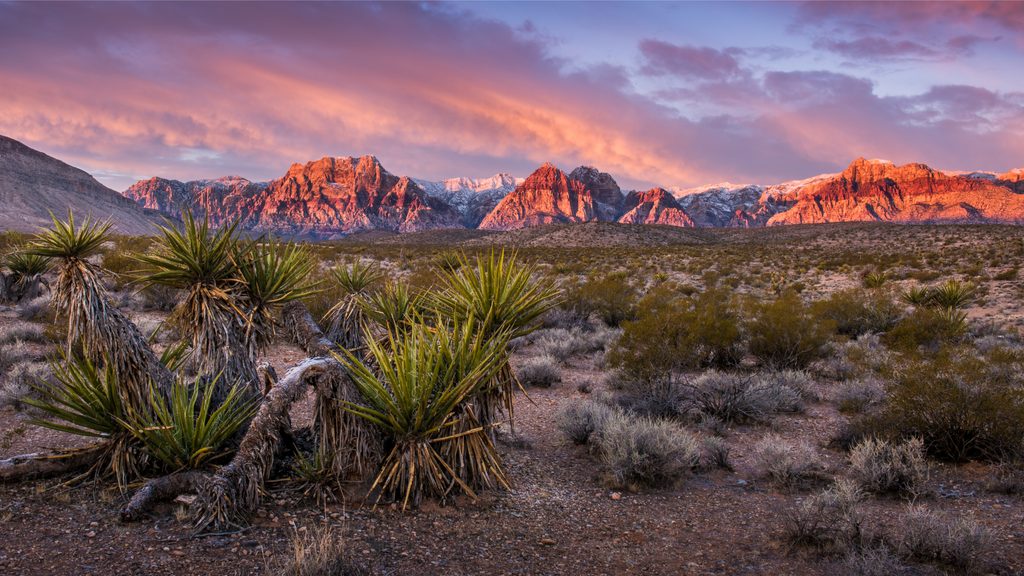
Is Summerlin Eventually Going to Reach the Red Rock Canyon Visitor Center?
This is a question I’ve heard discussed for years.
Some longtime residents remember early descriptions suggesting Summerlin would eventually extend much farther west, possibly toward the Red Rock Canyon Visitor Center.
Interestingly, the original Hughes landholdings did extend toward the Red Rock Canyon area. However, the federal land exchanges in 1988 and 2002 changed the development landscape considerably by transferring environmentally sensitive western acreage into federal protection.
That distinction is important.
The boundaries of Howard Hughes’ original property are not necessarily the same as Summerlin’s current development boundaries.
Based on the published history and current planning information, there is no verified basis for saying that Summerlin will eventually develop residential neighborhoods all the way to the Red Rock Canyon Visitor Center.
The conservation area’s federal protections and the boundaries established through past land exchanges remain important factors in determining where future development can occur.
.

.
Summerlin West: Where Growth Is Happening Today
If you’ve driven through Summerlin West recently, you’ve probably noticed how dramatically the area has changed.
New neighborhoods, roads, parks and residential developments have continued to take shape west of the 215 Beltway.
Communities in and around Redpoint, Kestrel, Grand Park and the surrounding western villages demonstrate how Summerlin’s long-term plan is gradually becoming reality.
Luxury development is also expanding into some remarkable locations along the western and northwestern edges of the community.
One of the most interesting examples is Astra at La Madre Peaks.
.

.
Astra at La Madre Peaks: A New Chapter in Summerlin’s Growth
Perched at nearly 4,125 feet above sea level, Astra at La Madre Peaks is being developed as one of the highest-elevation residential communities in the Las Vegas Valley.
Located against the dramatic backdrop of the La Madre Peaks, Astra will feature 167 custom homesites across approximately 171 acres.
Unlike traditional production-home neighborhoods, Astra’s homesites vary in size, shape and orientation, allowing homeowners to work with custom builders to create residences suited to their individual properties.
The community is planned to include a guard-gated entrance, a clubhouse with lounge, veranda and pool, and private access to an adjacent trailhead connecting residents to surrounding outdoor amenities.
I recently visited the area to see the progress firsthand and captured some spectacular drone footage of the development.
Standing at that elevation, surrounded by the mountains with views stretching across the Las Vegas Valley, gives you an entirely different perspective on Summerlin’s continuing growth.
It’s also a reminder of why understanding the relationship between development and conservation is so important.
.

.
What About the Hiking Trails and Open Space?
For hikers, cyclists and outdoor enthusiasts, one of the biggest concerns surrounding new development is whether access to the surrounding desert will be affected.
It’s an understandable question.
Red Rock Canyon National Conservation Area is federally managed by the Bureau of Land Management and offers an extensive network of recreational opportunities.
Summerlin itself also includes a substantial network of neighborhood trails and pathways.
However, it’s important to distinguish between private community access points, public recreational trails and federally protected conservation land.
For example, Astra’s proposed private trailhead access does not necessarily mean that the trails beyond the community are privately owned or restricted to residents.
Likewise, the presence of federal land near a development doesn’t automatically establish the exact boundaries or future land-use restrictions for every adjoining parcel.
For anyone considering purchasing property along Summerlin’s western edge, I always recommend confirming the specific property boundaries, surrounding land ownership, planned infrastructure and trail access rather than relying solely on marketing descriptions.
These details can be especially important when evaluating views, privacy and long-term development potential.
.
What Does Summerlin’s Future Growth Mean for Homebuyers?
For buyers considering Summerlin West, understanding the community’s remaining development potential is an important part of making an informed decision.
A home that enjoys expansive open-desert views today may eventually overlook another neighborhood if the adjoining land is designated for future development.
On the other hand, properties bordering confirmed conservation land may offer a different long-term setting.
Other considerations include planned roads, parks, commercial centers, construction activity and neighborhood amenities that may develop over time.
This is particularly important when evaluating luxury homesites, where elevation, orientation, surrounding terrain and future views can significantly influence the property’s appeal.
Before purchasing, it’s worth taking the time to understand not only what exists today, but also what may be planned nearby.
.

.
The Bigger Picture: Growth and Preservation
Summerlin’s story is more than a history of new homes and expanding neighborhoods.
It is also a story of land planning, long-term development and conservation decisions that began decades before the first residents moved into the community.
Howard Hughes’ original 1952 purchase laid the foundation.
The 1988 and 2002 federal land exchanges helped establish important protections near Red Rock Canyon while redirecting development to other portions of the valley.
And today’s ongoing construction reflects a community that is still evolving more than three decades after development began.
.
So how far west will Summerlin grow?
The answer lies not simply in how much undeveloped desert remains, but in the established development boundaries, approved land-use plans and protected conservation areas that shape Summerlin’s western edge.
For those of us who love living near Red Rock Canyon, understanding that history makes the relationship between our growing city and the surrounding natural landscape all the more fascinating.
.

.
Thinking About Buying or Selling in Summerlin?
Whether you’re exploring a new neighborhood in Summerlin West, considering a luxury custom homesite, or preparing to sell an established Summerlin property, understanding the community’s growth and future plans is an important advantage.
I’ve been helping buyers and sellers navigate the Las Vegas real estate market for more than 20 years, with a special focus on Summerlin, luxury properties and the west Las Vegas Valley.
I’d love to help you explore your options.
.
And a special shout-out to Friends of Red Rock Canyon, a wonderful local nonprofit dedicated to preserving and protecting this extraordinary landscape. Through volunteer efforts, trail maintenance, native plant restoration, and wildlife conservation, the organization helps ensure that Red Rock Canyon remains a treasure for generations to come. If you’re looking for a way to support their work, you can volunteer, become a member, or even purchase a special Nevada Red Rock Canyon license plate that helps fund their programs.
.
Information based on publicly available Summerlin, Howard Hughes Communities and Bureau of Land Management materials. Development plans, land uses and access arrangements may change. Buyers should independently verify property-specific information.